DE
FR
IT
EN
Directory
Weather
Map / Route
Timetable
Leisure
TV guide
Cinema
Web search
Apps
More
Personal Data »
Login:
Register
Password forgotten
or
Log in with local.ch
Log in with Apple
Log in with Facebook
Log in with Google
Log in with LinkedIn
Please note that our new
privacy statement
as well as the revised
terms and conditions of use
apply.
Leisure
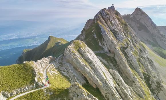
Hike in Vallée du Trient
Chemin des Bisses
Regional route No. 58, Martigny (Col des Planches) – Grimentz
Description
Regional route
No. 58 (Martigny (Col des Planches) – Grimentz)
Length
105 km
Ascent • Descent
↑ 4700 m • ↓ 4600 m
Lowest point • Highest point
946 m • 1779 m
Grade
easy
Fitness level
medium
Regional route No. 58: Chemin des Bisses
Stages
1. Martigny (Col des Planches) – La Tzoumaz
2. La Tzoumaz – Nendaz
3. Nendaz – Veysonnaz
4. Veysonnaz – St-Martin
5. St-Martin – Nax
6. Nax – Vercorin
7. Vercorin – Grimentz
The skilfully laid «bisses» irrigation channels are evidence of Valais history and culture. Fabulous flora along the way, the babbling water so soothing. The «Chemin des Bisses», a hike for all senses, follows the holy waters.
Comments on this information?
We welcome your feedback!
Presented by
Route
Height profile
Weather:
More...
Further recommendations
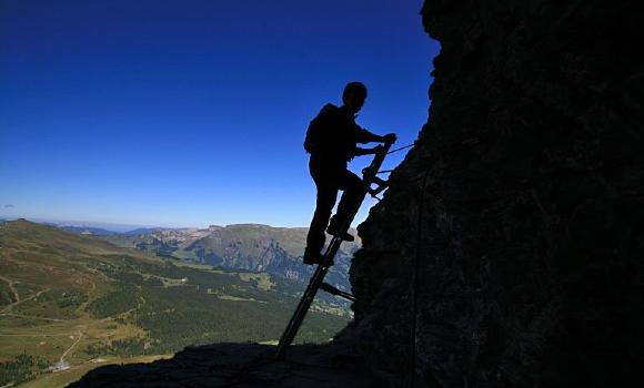
Climb
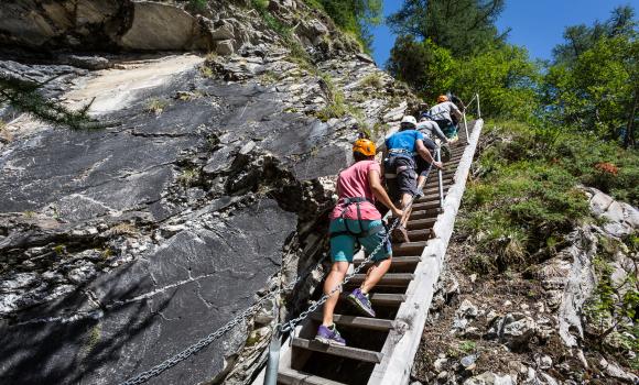
Via Ferrata in the Mauvoisin Gorge
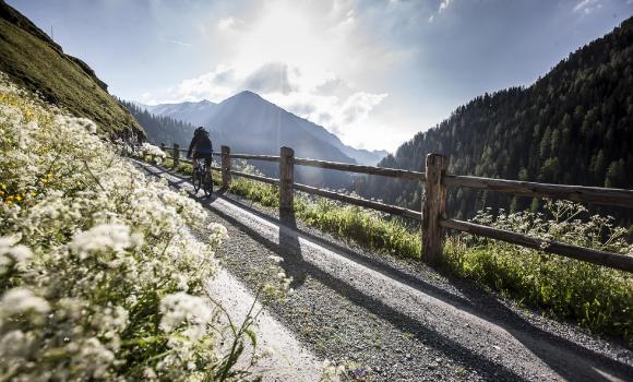
Mountain bike
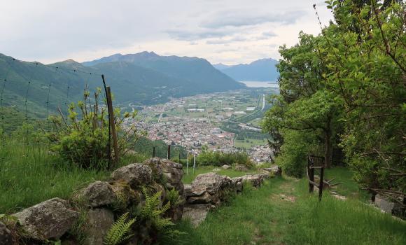
Valle Morobbia Bike
Mountain bike
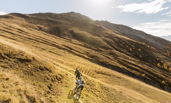
Torrenttrail Bike
Climb
Eiger-Rotstock - via ferrata with a feel of the North Face
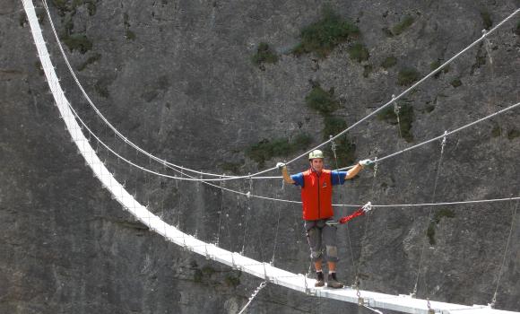
Via ferrata
Via ferrata Mürren
Canyoning
Playful Val Corippo
Climb
Mountain tours, climbing
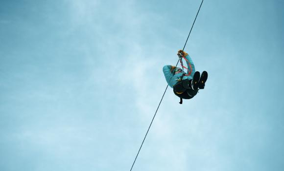
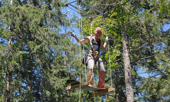
Rope park
Adventure Park Rehärti, Adelboden
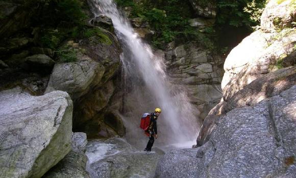
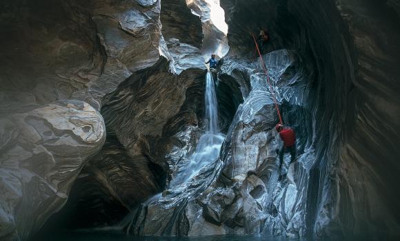
Canyoning
Canyoning in the Malvaglia Valley
Rope park
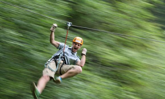
The valley of the zip lines
Mountain bike
Salaaser Kopf
Alpine hike
Your first 4,000-m peak
Rope park
Fun and adventure in Balmberg
Canyoning
Massa Gorge
Alpine hike
A 4,000m summit for all - Allalinhorn
Alpine hike
Hiking on Mount Pilatus
Comments about this activity or place?
Incorrect information
Missing information
Another topic
Thank you for your feedback!
Close

..Grimentz&freizeit=1&noweather=1&width=400&height=200&x_axis_display=distance&polyline=ekcb%40yglE_wA%3F%7Bv%40_XmEgbAsn%40w%5CiCebAcp%40%7D%5DqCmcAya%40wYsBgaA%7BGi%5EfGuaAqp%40uKpBibAat%40gFqA_bAme%40cg%40%5DgbA%7Be%40kc%40eFyaAco%40wIKkbAsf%40_%5EW_bA%7Dd%40u%5CG_bAoq%40f_%40GcbAgk%40pf%40MebA%7B%60%40cTGcbAk_%40ed%40%3FcbAwl%40xOUebAk%5DiJSobAqCyt%40C%7BaAjg%40uf%40GqbAA%7Bq%40KwaA%7Cm%40eUKcbAmo%40q%60%40vCabA%7B%5Cai%40nH%7BaA_y%40k%5CpEubAq%7D%40vA%7D%40saAo%5E%60%5Ew%40ebA_Qjx%40e%40%7DaAyHd_Ao%40qbAeQr%7C%40Z%7BaA%7BI_t%40fBabAwS_%7B%40n%40ibAoYsm%40l%40ebAcVaj%40%60%40ybA%7Bz%40cGRkaAtVyi%40n%40yaAjJg%7C%40NgbA%7Bu%40%7D%5B%5CebA%7Dt%40iVF%7BaAc%7D%40iQHibAw%7D%40fC%5C%7BbAec%40ds%40wBuaAy%5B%7Cv%40tCuaAaTpt%40%7EEibAyQ%60PfJcbAh%5C%60v%40c%40_bAdF%7Ck%40oCgbAmt%40%7B%5D%7DD%7DaAm%5Bge%40jJibAoq%40j%5Cb%40obA%7B%5C%7Ea%40A%7BaAaX%7BBBubAcJy%5BcKgaAp%40ek%40yKsbAnXex%40uAwaAej%40jg%40cG_bAqp%40za%40aGqbAli%40_o%40dAyaAeQmp%40gBebA_o%40g%5DSibAsO_m%40xA%7BaApd%40gJgBkbAz%7C%40kGtD%7BaA_M%7Dn%40eAubAmBir%40kByaAxf%40kSvEuaAnSso%40fGkbAf_%40oQnI%7BaAcM_WrC%7DbAc%7D%40wNk%40yaA_x%40%60Ml%40waAu%5Cym%40dB_bA%7D%5Eob%40xEubAc%7D%40cIc%40ibA%7Dp%40mBkDabAqa%40vp%40k%40uaAka%40pu%40cIwbA_Ubt%40mKiaAgIdBqCybA%7CBqx%40%60%40uaArFqz%40VgbAcUan%40%7CBgbAsg%40if%40%7CCqbAec%40qV%60FebAyQw%5B%7ECsaA_i%40vDfJabAeWnHrDcbAeq%40o%40%3FwaAwWrr%40IebA%7DQzx%40OibA_Qxt%40e%40cbAqL%7Cp%40NgbArG%7ENwJsaAmQ%7C%5DtBabA%7DGzr%40kDgbAyQdv%40uBacAkElu%40%7BBiaAmIf%7E%40c%40abA%7C%5Epq%40iCkbArMqO_EuaA)